Being born, raised, educated and working here in Pampanga, it is hard not to notice the lone summit of the province, Mt. Arayat, with our everyday mundane life. There are times whenever I see it slopes gleaming from my office window, will I ever summit this mountain?

HOW TO START YOUR TRAVERSE TO MT. ARAYAT?

According to the trail guides, it is recommended to start your traverse at the Magalang Side, traversing from North Peak to the South Peak, eventually descend to San Juan Baño, Arayat, Pampanga.
Mt. Arayat Commute Guide
- Best Option is taking Five Star bus and alight at Marquee Mall in Angeles City.
- From there, take jeepney bound to Magalang, Pampanga. Request the driver to drop you at the Brgy. Ayala/Banal na Bundok tricycle terminal.
- Ask the tricycle driver to drop you off the Fourth Station or DENR Registration Area.
- Alternatively, you can alight in Dau Bus Terminal (different Bus Line) and take a tricycle ride to Marquee Mall or find the Marquee Mall Jeepney Terminal which is beside the New McDonald’s Dau Branch. The jeepney terminal is across the road from the Mabalacat City Bus Terminal Main Entrance.
- If you are arriving before dawn, Magalang-bound jeepneys are quite rare. You can possibly charter a jeepney and let the smile and haggling skills be at practice. Tricycle ride might be too expensive and far from Marquee Mall to Magalang town proper.
After finishing your traverse hike and ending up in San Juan Baño, request your trail guide to call for tricycle pick up you from the DENR Ranger Station to Downtown Arayat.
- Take jeepney bound to SM City Pampanga and alight there.
- From SM City Pampanga, cross the overpass and take buses bound for Manila in Robinson Starmills Pampanga.
- For North bound passengers, take the Dau bound jeepney in SM City Pampanga and alight at the Dau Bus terminal.
TIPS
- Should you traverse Mt. Arayat, bring garden gloves. The South Peak side has lots of thorny plants and vines. Be aware of dangling sharp or thorny vines, stems, shrubs or tree trunks.
- Bring at least 2 liters of water
- Bring waterproof protection for your backpack and electronic gadgets
- Bring trail food.
- LEAVE NO TRACE PRINCIPLE PLEASE. Do not litter anywhere. Bring your trash with you.
THE STORY GUIDE
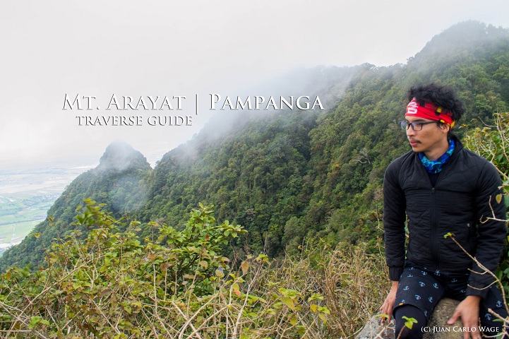
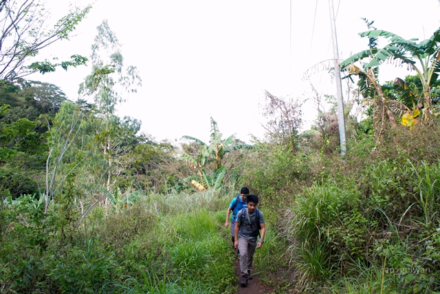
With the efforts of Juan Carlo (@kamehamewage), his will to challenge himself to summit Mt. Arayat’s two peaks led to him to form a group of climbers to assault the tricky slopes of the mountain. On a sunny 28th of January 2017, the group became complete and started the commute up to Brgy. Ayala, Magalang, found on the soles of Mt. Arayat.
Being there for the first time in my 30 years of existence in Pampanga, I was astounded by the panoramic view of the province even just at the lower levels. Heading to the registration station, I prepared myself for this trek “mentally”, a silent mantra running around my deep thoughts “I can do it!”.

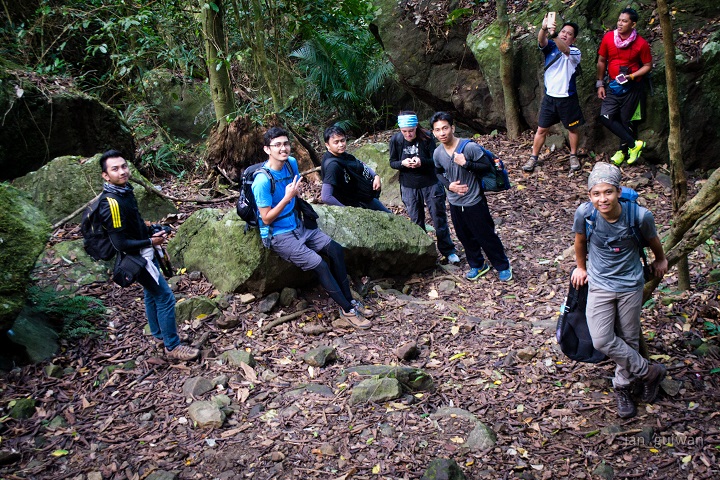
Listing my name in their registration roster officially starts our assault and reminders were given by our ever supportive guide, Sir Renato Reyes. The common rule of thumb in mountaineering, LEAVE NO TRACE!

Momentarily, I started treading my sleepy feet over Mt. Arayat’s lower slopes. Passing by the iconic 14 Stations of the Cross, I have witnessed friends and families having their bonding sessions here.

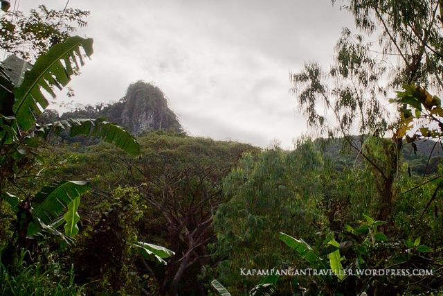
As we steereded to the right leaving the last station, we are now heading to its famous White Rock, found over the belly of Mt. Arayat, facing western Pampanga. I have been hearing most of my lifetime and having found myself sauntering the trail leading to it gives me a sense of fulfillment.


With momentarily halts over the trail to catch our breath and advancing earlier groups, my motivation to reach this rock pushed me to my climbing limits just to reach halfway to the summit, where the White Rock is located. We momentarily rested on the crossroads and started for the trail leading to the view deck. I screamed my enjoy as I saw the amazing panoramic view from the deck and jumped on the huge rock to take snapshots.

As we left the view deck, the heavens let off a drizzle and started covering my backpack. Heading now to the North Peak, the dry trail slowly turned into a slippery and muddy trail that added the challenge. The blue sky turned to white and started covering the mountain, obscuring our occasional view of the plains below.
Leading me to the last steps before the summit is the ultra slippery muddy dugout stairs, thanks to the ready rope we advanced these tricky steps and there I found myself at the summit of the North Peak! I screamed my fulfillment.

We had our lunch at the crude hut beside the police post and our view of Eastern Pampanga completely obscured by thick fog as the cold moist wind kept blasting on us. After a brief rest and timelapse directed by Sir Kendell (@kundolss) we are now heading to the traverse trail.
Starting off with the rappel down through a slippery muddy trail, one by one we grabbed on the rope and supporting each other as we landed on the lower end, catching the foot of each climber to avoid slipping. We descended more on a mossy and the enchanting forest trail towards the “Knife trail”, the ridge connecting the North and South Peak. Seeing from the Angeles City as the vantage point, this ridge seemed to be a plateau, but it is actually, a very thin ridge, at some portions approximate 3-4 feet wide enough to allow a single file group. It has taken us more than an hour to traverse this ridge since the trail is not fairly flat but with varying degree. This was the coolest part of our hike as the Northeast monsoon kept on blasting the eastern face of the mountain. The sound from deep in the forest seemed like huge waves crashing hardly against a rocky coast, such a great ambivalence of nature!
Approaching “Haring Bato” (English: King Stone) gave me a thrill as another panoramic view is unveiling itself and a bit of clearing. And as we approach to the view deck in the middle of the Knife Ridge, the panoramic view of the Western Pampanga and the towering Summits on both sides is on view! A cloud line though is partly obscuring the North Park, nevertheless, I can see all the summits including, what the trail guides call, the “Pinnacle”. It was the scream of the thrill of Alison (@theealison) that made this remarkable. It was one of this best panoramic along the trail on the mountain. As the time the limiting us over the view deck, one by one we made another rappel against a flat rock. I did the first turn after the guide, challenging my fear of heights. One by one as I slowly descended over this tricky part with my gloved hands tightly gripping the rope saving me from a sheer fall. Thank you with the loose roots as there are strategically positioned where we can grasp and step onto a safe landing. That was one hell of a trail!


As we continued on the mossy forest trail exuding an enchanting and mystic feel, there we are heading the south peak. Do not be fooled of the first ascending trail as this does not yet lead to the foot of the south peak. The trek is quite longer than I thought. As you get near the South Peak, the trail ascends too steep that upper body strength is required to pull yourself up over the seemingly undulating sheer trail.
Leading to a campsite covered with forest canopy, our guide invited us for a brief rest before going to the viewpoint on the South Peak.

From the South Peak viewpoint, you need to descend on a steep trail leading to the picture point should you wish to have the Pinnacle Summit as your backdrop. This descend gave shook my knees because of the sheer cliff right beside with nothing but stray roots as your steps and handles. The moment you got there, the experience and view is exhilarating!

After taking snapshots for the momentary clearing, we head back to the viewpoint and start our long way hike down leading to San Juan Baño, Arayat. The trail is longer according to our guide and it took us almost 6:00PM to reach the DENR Ranger Station.

The experience of summiting the lone Pampanga mountain is truly one for the books, for me. As I glance each day on the mountain after my climb, I could say to myself, “I’ve made it at the top!”

| MT. ARAYAT BUDGET (from Manila) | |||
| ITEM | COST | ||
| Bus from Cubao to Dau | ₱139.00 | div by 1 pax | ₱139.00 |
| Jeep from Dau to Balibago | ₱7.00 | div by 1 pax | ₱7.00 |
| Tricycle from Balibago to Marquee Mall | ₱50.00 | div by 2 pax | ₱25.00 |
| Jeep from Marquee Mall to Magalang | ₱23.00 | div by 1 pax | ₱23.00 |
| Tricycle from Magalang to Brgy. Ayala | ₱120.00 | div by 3 pax | ₱40.00 |
| Trail Guide Fee | ₱1,500.00 | div by 7 pax | ₱214.29 |
| Tricycle from San Juan Baño to Arayat Proper | ₱50.00 | div by 3 pax | ₱16.67 |
| Jeep from Arayat Proper to SM City Pampanga | ₱27.00 | div by 1 pax | ₱27.00 |
| Bus Robinson Starmills Bus Terminal to Cubao | ₱100.00 | div by 1 pax | ₱100.00 |
| TOTAL | ₱591.95 | ||
VISUAL GUIDE OF THE TRAVERSE TRAIL OF MT. ARAYAT
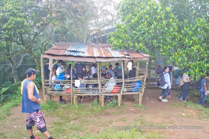
THE REGISTRATION AREA AT THE MAGALANG SIDE


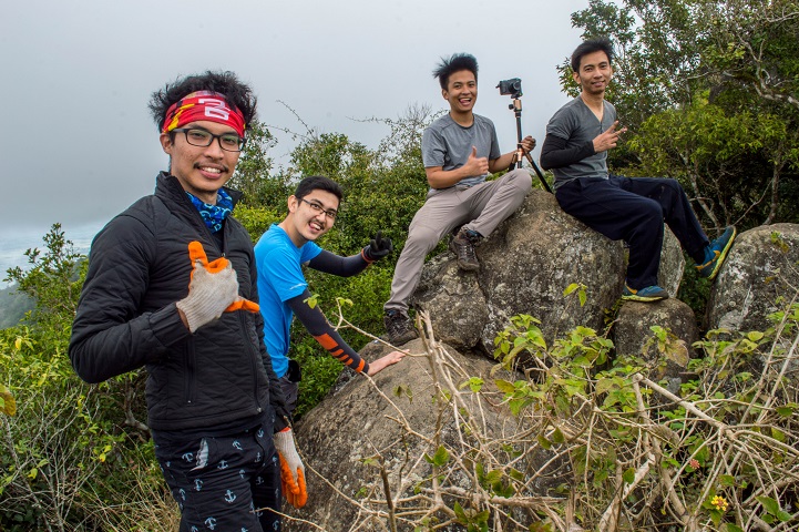
MY CO-CLIMBERS and INSTAGRAM ACCOUNTS


Sir day hike lang ito noh? pwedeng walk in lang din? sundan ko lang yung guide mo dito.. 🙂
LikeLiked by 1 person
Hi Sir, yes day hike only. Pwdeng walk in din. Better if you start sa Magalang side, instead of the Arayat side. 🙂 Enjoy your hike. Would be waiting for your post.
LikeLiked by 1 person
I hope i can do it this year.. 🙂 I will post as soon as naakyat ko yan.. 🙂
LikeLike
Sir! 🙂 gamitin ko tong guide mo.. I will be coming from baguio.. sa april 2.. 🙂
LikeLike
uy wow, nice, who’s with you sir?
LikeLiked by 1 person
friends po.. and my 2 akong imemeet sa dau na sasama.. hahaha less than 10 siguro kami.. 🙂
LikeLike
and sir baka may marecommend ka namang guide pala for april 2? 🙂
LikeLike
Sir magtatanong lang ulit ako.. sir may mga van ba from dau papuntang magalang?
LikeLike
Sir wala man, magtricycle ka na lang from Dau Bus Terminal to Marquee Mall. Tapos may jeep na dun going to Magalang. Sabihin sa driver ibaba sa tricycle terminal ng brgy ayala
LikeLiked by 1 person
si sir renato yung naging guide namin you can ask for him there
LikeLiked by 1 person
Thank you po sir! 🙂 laking tulong.. 🙂 sana matuloy kami.. kasi sabi nung isang contact namin nakared alert daw ang mt arayat dahil sa anniv ng npa? veverify palang namin…
LikeLike
Hello Sir, Ask ko lang kung what time kayo nag start at what time kayo natapos?
LikeLike
Hello, we started at around 08:30AM at the jump off point and finished at around 6:00 PM for the traverse trail. Advisable to start as early as 3:00 AM or 4:00 AM and witness the sunrise at the northpeak and enjoy the commanding view of the Pampanga and Nueva Ecija plains. 😀
LikeLike
ser may parking b pag overnyt kmi sa north peak.salamat
LikeLike
yes may parking sa brgy ayala magalang jump off point. am not aware sa parking fees but i am assuming d naman ganoon kamahal
LikeLike
saka pag galing ako blintawak nlex sn po ko mag exit
LikeLiked by 1 person
exit ka sa Angeles Tollgate and ask the teller for directions to Magalang. Once in Magalang downtown. Ask for directions bound to Brgy. Ayala, expect to pass through Pampanga Agricultural State Uni. locals are happy to assists hikers.
LikeLike
Sir. pwede po ba malaman po ung no. ni Sir. Renato Reyes, un pong tour guide nila? Salamt po…
LikeLike
apologies sir ed. i dont have the contact number of sir renato. however, guides are readily assigned at the registration
LikeLike
hi sir! ask ko lang po kung required yung tour guide?
LikeLiked by 1 person
hi erie, yes required ang tour guide as per DENR. May makukuha kayong guides on Magalang and Arayat jump off point. Fees differ sa mga pipiliin nyong trail or aakyatin.
LikeLike
Pano po pag good for 2 persons lang may changes po ba sa trail guide fee? thanks
LikeLike
The guide fee is up to maximum 7 climbers for the Traverse trail.
LikeLike
Hello po. Salamat po for this guide. Bukas po ba ang DENR for registration during holidays or weekends? Kung sarado at hindi po nakapag-register sa kanila, not allowed na po umakyat? Salamat po Sir.
LikeLike
There are guides usually during weekends and holidays as they are expecting more climbers, I assume. Thank you
LikeLike
sir pwede mag over night dyan? then makikita mo sunrise or sunset.
LikeLike
patag po ba ang tuktok niyan kung saan pwede mag set ng camping
LikeLike
Yes, pwde, best to camp at the North Peak, may area talaga dun facing the eastern horizon, wait for sunrise there.
LikeLike